

NOTE: "HOME" takes you to our
initial home page; "UP" will return you
to the Eastern US 2002 site
for more exploring.
Boy, the Eastern U.S. has some tremendous spots for viewing
great natural beauty and appreciating historical events not to mention for just
plain having fun!
Our travel adventure began in Nashville. Now,
we’re not country music fans, but a night at the Grand Ole Opry can help you
become one! We enjoyed a wonderful live show which is also broadcast live
over the radio. The performers have
to be prepared to lengthen (or shorten) a performance to accommodate how the
show is going. While in Nashville,
we also went to the Country Music Hall of Fame and enjoyed it too. Where
else do you see such outlandish costumes, especially those that some of the male
stars wore.
After leaving Nashville, we went through the Smoky Mountain Park in Tennessee
and then in North Carolina. It was
very lush and beautiful. Then, we
picked up the Blue Ridge Parkway at its beginning in North Carolina and followed
it through Virginia. It was one of
the prettiest byways we’ve ever been on.
The road seems to get lost in the dense forest surrounding it, especially
since it winds and snakes its way through the area.
GREAT SMOKY MOUNTAINS
Click on the image to display a larger photo. Once
displayed,
click on the BACK button (first button on the left of your browser)
to return to this page.
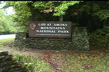 |
The entry into the Park in Tennessee |
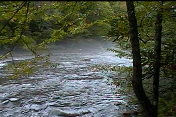 |
A trout stream in the Park (NOTE: It was always cloudy and misty during our visit and this is the typical weather in the Park) |
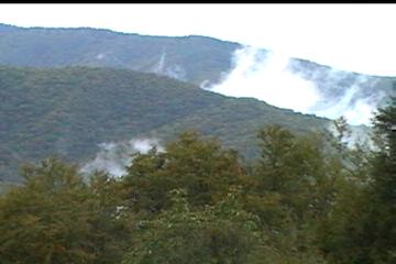 |
A view of the mountains in the Park taken from North Carolina |
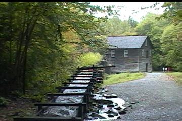 |
This mill & sluce, powered
by a water-driven turbine, is used to grind wheat & corn. It was built at the turn of the century & is still used daily. |
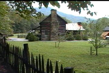 |
This Appalachian farmstead was restored by the National Park Service |
BLUE RIDGE PARKWAY
Click on the image to display a larger photo. Once
displayed,
click on the BACK button (first button on the left of your browser)
to return to this page.
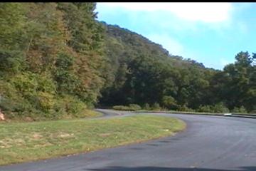 |
The Parkway
-- 469 miles of 2 lane road with |
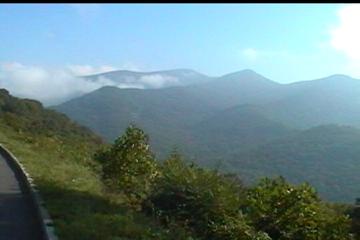 |
A view of Mt. Mitchell in
North Carolina. It's 6,600' tall and is the highest mountain east of the Mississippi |
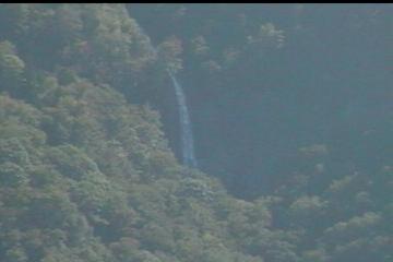 |
Glassmire Falls, some 800' tall |
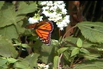 |
A beautiful Monarch butterfly |
We next took another scenic byway, Skyline Drive, through the Shenandoah National Park through Virginia and toward D.C. Again, it was incredibly beautiful. We also made a stop at the Manassas Battlefield. Manassas (also known as Bull Run) was the site of two Civil War battles. Manassas was the first place that the Northern & Southern troops met in battle. It occurred in July 1861. Initially both sides thought they could quickly defeat the other. However, after heavy fighting and the loss of life of some 900 young men, both recognized the war would not be a short one. The second battle of Manassas occurred in August 1862. This battle, which took three days and some 3,300 lives, brought the Confederacy to the height of its power. The battlefield itself is quite large and has some 11 sites that figured prominently in one or both battles.
SHENANDOAH NATIONAL PARK/MANASSAS
Click on the image to display a larger photo. Once
displayed,
click on the BACK button (first button on the left of your browser)
to return to this page.
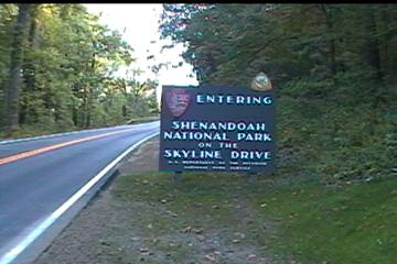 |
Shenandoah
National Park was dedicated |
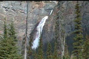 |
Ta-ka-ka-we Falls (named by the Cree Indians) |
 |
Manassas Battlefield National
Historic Park
A view of the Union artillery line on |
 |
A view of the trees where
Stonewall Jackson led Confederate troops to their first victory "Form, form 3 stands like a stone wall" |
Our next sightseeing occurred in Philadelphia. There we had the great pleasure of seeing both the Liberty Bell and Independence Hall. You can’t help but feel pride and patriotism after seeing these icons of liberty.
PHILADELPHIA
Click on the image to display a larger photo. Once
displayed,
click on the BACK button (first button on the left of your browser)
to return to this page.
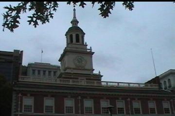 |
Independence
Hall |
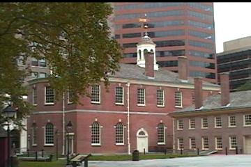 |
Congressional Hall |
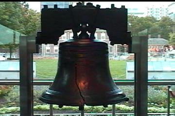 |
The Liberty Bell |
After multiple breaks with family, we headed into Connecticut. We visited the Nautilus Submarine Museum which was quite outstanding! Then, we spent a day at Mystic Seaport, a re-created fishing village where individuals dress in traditional clothing and continue the crafts from decades before.
NAUTILUS SUB MUSEUM/MYSTIC SEAPORT
Click on the image to display a larger photo. Once
displayed,
click on the BACK button (first button on the left of your browser)
to return to this page.
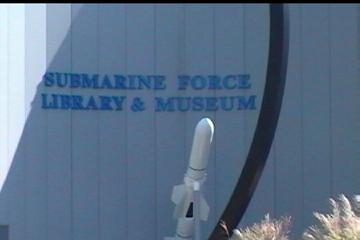 |
Entry to the Museum |
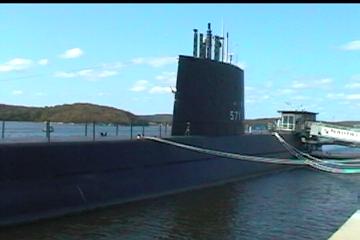 |
SSN571 - The 1st
submarine with a nuclear power plant; building 50 years ago (1952) during the Cold War |
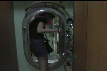 |
Lindy going through one of the
bulkheads on the SSN571 |
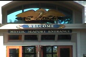 |
The entry at Mystic Seaport, a
recreated seaport village |
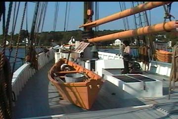 |
On board "The Dunton,"
a fishing ship. The dory (boat on the deck) is what the fisherman actually fished from - not the big ship. The big ship's hull was used to store the catch which was cod. |
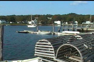 |
Lobster & crab pots |
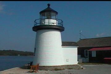 |
Mystic's Lighthouse |
We then continued into Rhode Island. Here we spent one day doing a tour of famous Newport Mansions. As Ed had told me in advance, if Karl Marx had set-up shop outside one of these incredible homes, he could probably get lots of signees into the communist party. The decadence and wealth of these homes and the individuals who owned them (e.g., The Vanderbilts) is unbelievable. From Lindy’s perspective, it makes rich Texans look like they live a modest life style.
NEWPORT
Click on the image to display a larger photo. Once
displayed,
click on the BACK button (first button on the left of your browser)
to return to this page.
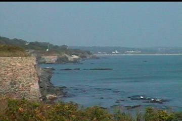 |
A view of the Atlantic coast |
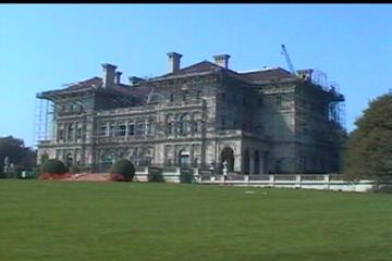 |
The "summer home" of
Cornelius Vanderbilt's family. This home has only 74 rooms versus the Vanderbilt's permanent home on 5th Avenue, NY which had 156 rooms. Their NY home is now Bergdohf's Department Store |
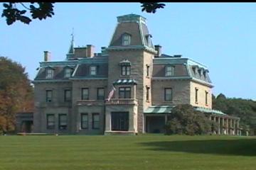 |
Chateau-Sur-Mer |
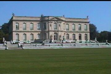 |
Back view of The Elms & its lawns |
After Rhode Island, we traveled into Massachusetts.
We enjoyed two days on Cape Cod. It’s
got wonderful natural beauty and it is really a great place to unwind.
They also have some great foods and shopping and we enjoyed both!
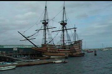
We then left the Cape and went up the Massachusetts coast to visit Plymouth.
We know Ed’s family didn’t arrive here and it’s highly unlikely any
of Lindy’s did either, but it was fun to see where the Pilgrims founded their
new home.
After spending time in Foxboro with Ed’s niece, we continued northward.
We stopped outside Boston to visit the Minute Man National Historic Park
which encompasses the towns of Lexington and Concord.
It was here that the American Revolution began on April 19, 1775 on the
20 miles of winding, hilly roads connecting the port city (Boston) to the
countryside. Ralph Waldo Emerson
coined the phrase “the shot heard ‘round the world” to describe the
significance of the brief battle that took place at the North Bridge at Concord
where American militia drove back the British troops.
Ultimately, the British troops retreated to Boston.
However, en route there seemed to be an American musket behind every
tree. All along the road of
retreat, the American citizen-soldier used what we would today call gorilla
warfare tactics to pick off soldiers one by one without ever being seen.
An invisible enemy is a tough one to combat.
All that prevented mass anarchy among the British troops was the arrival
of 1,000 reinforcements at Lexington. Then,
the balance of the retreat into Boston was conducted with nominal bloodshed.
Lexington and Concord are also known for the famous “Midnight Ride of Paul
Revere.” Revere observed a
lantern signal from the tower of Old North Church in Boston which signaled that
the British were heading to Lexington and then Concord to confiscate arms.
He rode to give advance warning to the colonists that the British were
coming.
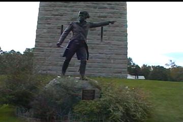
MASSACHUSETTS
Click on the image to display a larger photo. Once
displayed,
click on the BACK button (first button on the left of your browser)
to return to this page.
 |
Plymouth, MA |
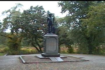 |
Statute of a Minute Man, the Colonial Militia |
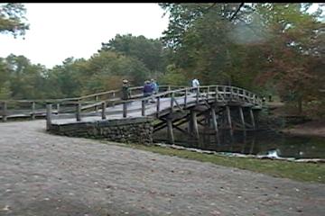 |
North Bridge, Concord, MA British troops confronted the Colonial Militia here & fired "the shot heard round the world". The Revolutionary War began here in April 1775. |
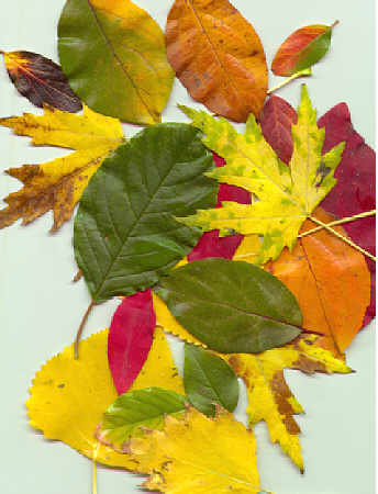
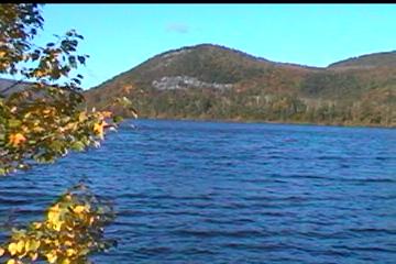
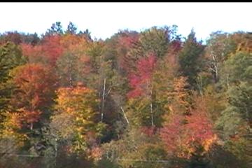
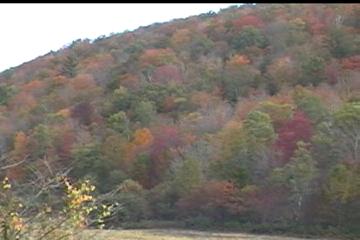
After leaving the Park, we traveled north into Maine.
Here we toured Acadia and began to be “leaf peepers” (as we were
called by the locals). The foliage
was outstanding! The colors are so
intense – red, orange, pink, yellow…. You’ve got to see it for yourself to appreciate it!
We spent the night in the coastal town of Bar Harbor.
There we enjoyed fresh lobster and corn at an outdoor restaurant where
your order was put in a net, then boiled in a huge pot over a wood fire and
served on a paper plate. Many
people in Maine say that’s the way lobster is supposed to be served!
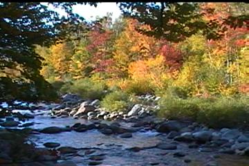
The next day we continued our “leaf peeping” in Maine.
We also found our first covered bridge near the town of Bethel, where we
spent the evening at a great place, The Sudbury Inn.
It was built in the 1870’s but had been modernized and was quite nice.
It also has a great pub with lots of local beers.
MAINE
Click on the image to display a larger photo. Once
displayed,
click on the BACK button (first button on the left of your browser)
to return to this page.
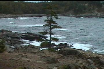 |
The rocky coast of Maine in Acadia National Park |
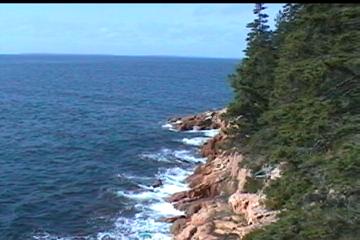 |
Another coastal view |
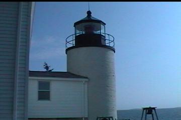 |
One of 63 lighthouses in
Maine; this one is still in use |
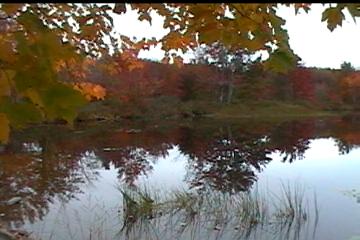 |
A Kodak moment! Gorgeous leaves reflected in a pond |
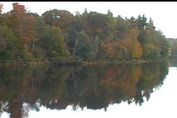 |
Another Kodak moment enroute to Bethel, ME |
 |
Our first covered bridge! (not in use) |
 |
A close-up view of the bridge built in 1972 |
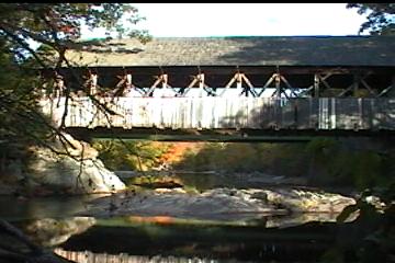
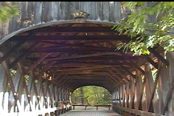
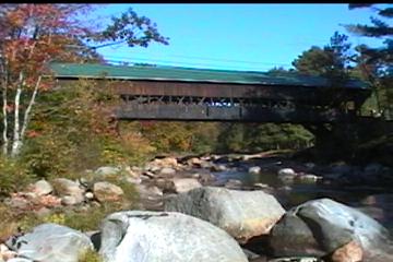
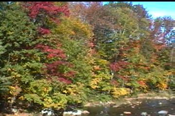
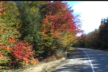
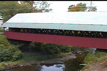
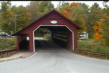
The next day, we wandered into New Hampshire staying just 10 miles south of Quebec, Canada. We then took the Kangamangus Highway through the White Mountains and on into Vermont. Talk about incredible foliage again! It was simply awesome! As we drove scenic routes in Vermont, we again found another covered bridge.
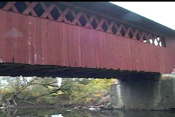
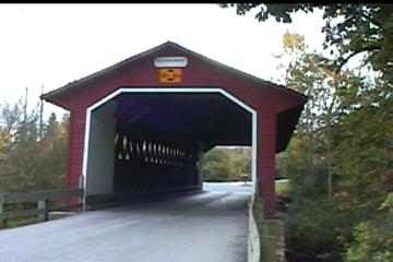
NEW HAMPSHIRE/VERMONT
Click on the image to display a larger photo. Once
displayed,
click on the BACK button (first button on the left of your browser)
to return to this page.
 |
An initial view of New Hampshire |
 |
A view while crossing over the White Mountains |
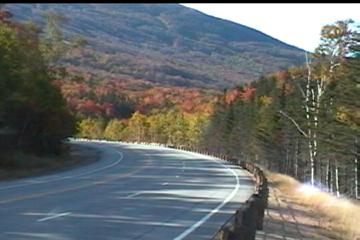 |
A view of color along the roadway |
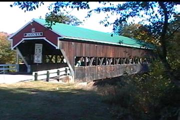 |
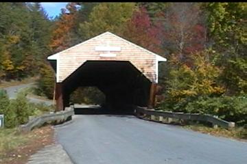
Our 2nd covered bridge.
This one is a one-lane bridge outside Jackson, NH which is still in use |
 |
Another view of the bridge
taken from the Ellis River (a trout stream) |
 |
Fall foliage as seen from the Jackson bridge |
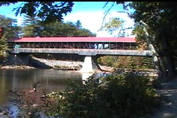 |
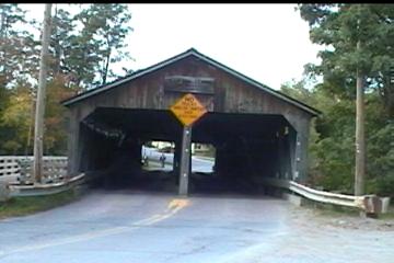
Our 3rd bridge outside Conway,
NH. It was built in 1890 over the Saco River, another trout stream. Notice it required a center pillar made of stone due to its length. |
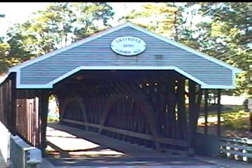 |
Another view of the bridge over the Saco |
 |
Along side the Kangamongus Highway |
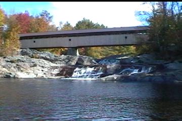 |
Our 4th bridge in the
backwoods of New Hampshire over the Swiftwater Creek; built in 1849 |
 |
Another view of the Swiftwater Creek bridge |
 |
Foliage on Vermont Route 100, ~10 miles south of Canada near Newport, VT |
 |
A roadside pullout in the
Green Mountains near Hancock, VT |
 |
The "Pulp Mill
Bridge", oldest in the State of Vermont. It's was built from 1808-1820 outside Middlebury, VT |
Upon leaving Vermont, we did some more historic touring as we returned into New York. Here we went to Fort Ticonderoga. This old stone fort controlled commerce across Lake George and Lake Champlain and was a significant factor in many battles involving the British, the French and the Americans. It was so well designed that it was never captured by force. However, it was the site of the first American victory over the British (after Lexington & Concord) in the Revolutionary War. Ethan Allan and the “Green Mountain Boys” from Vermont took the fort from the British by surprise without firing a shot.
NEW YORK
Click on the image to display a larger photo. Once
displayed,
click on the BACK button (first button on the left of your browser)
to return to this page.
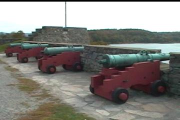 |
Fort
Ticonderoga, situated where Lake George |
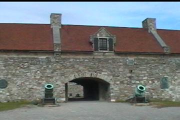 |
Entrance to the Fort's interior |
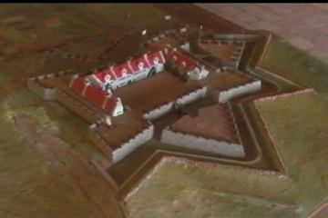 |
A model of Fort Ticonderoga
which shows the moat & cannon fortifications |
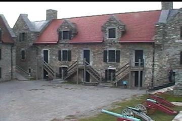 |
Inside the Fort with its
buildings and parade grounds |
The next day we wandered back into Vermont to again enjoy foliage and more covered bridges. We also had to pay a visit to the “mothership of fly fishermen.” Orvis has its headquarters in Manchester and we spent many an hour there. We also located more covered bridges. Amazingly, still in use!
VERMONT (Again)
Click on the image to display a larger photo. Once
displayed,
click on the BACK button (first button on the left of your browser)
to return to this page.
 |
"The
Silk Road Bridge" outside Bennington, VT |
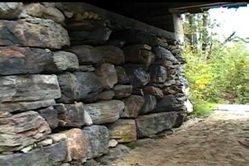 |
A view of the stones piled on
one another to form the base of the Silk Road Bridge |
 |
Another view of the Silk Road Bridge |
 |
A statute commemorating the Battle of Bennington during the Revolutionary War |
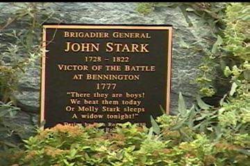 |
A close-up of the plaque which
basically states that even if death, the soldiers live since others live free through their efforts |
 |
"The Creamery
Bridge" outside Brattleboro, VT (our 7th covered bridge), built in 1879. |
 |
Another view of the Creamery Bridge |
When we left Vermont, we went to Old Sturbridge, Massachusetts.
This again is a re-created village where individuals dress is costume
period and undertake traditional activities, such as blacksmithing, quilting,
etc. It was fun and educational.
OLD STURBRIDGE
Click on the image to display a larger photo. Once
displayed,
click on the BACK button (first button on the left of your browser)
to return to this page.
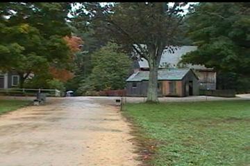 |
A scene in Old Sturbridge All structures were moved from original |
 |
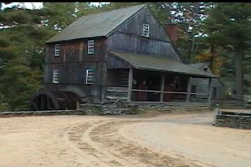
Freeman Farm in Old Sturbridge |
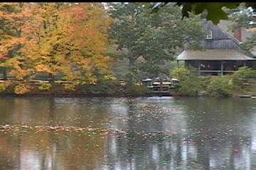 |
A Mill and Mill Pond
Apples are crushed here and made into cidar |
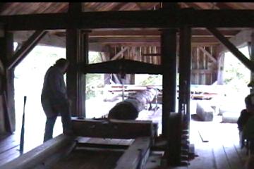 |
A tree is being sawed into
planks. The arm going up & down holds the blade which is cutting through the center of the tree |
 |
One of the buildings off the Commons |
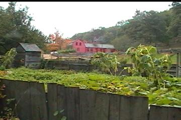
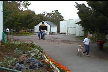
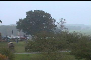
After meeting Ken & Cathy in Intercourse, PA (see Friends/Family), we spent time at Gettysburg, the “Highwater of the Confederacy!” This was the farthest north the Confederate Army marched. The battle here lasted three days and, in that brief period, over 50,000 Americans died. Lee’s army suffered a defeat and the South’s loss of the war was inevitable after this battle. You can’t help but be moved as you learn about the battle and the loss of life that occurred there.
INTERCOURSE
Click on the image to display a larger photo. Once
displayed,
click on the BACK button (first button on the left of your browser)
to return to this page.
 |
An Amish
farm used as a museum with |
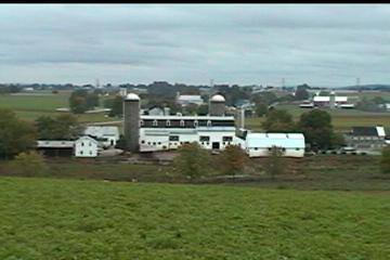 |
A working Amish farm in a pastoral setting (Note the lack of power lines) |
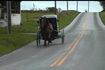 |
The carriages still in use today |
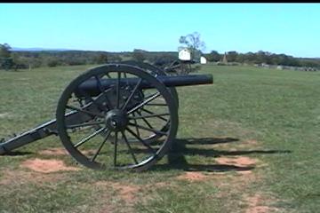
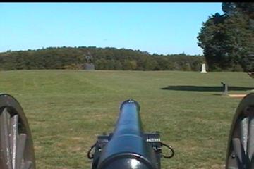
GETTYSBURG
Click on the image to display a larger photo. Once
displayed,
click on the BACK button (first button on the left of your browser)
to return to this page.
 |
Gettysburg National Historical Park Confederate lines at the base of the tree |
 |
This group of trees was the
site of Pickett's Charge
12,000 men were involved; 6,000 men died |
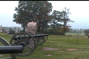 |
Some Union artillery |
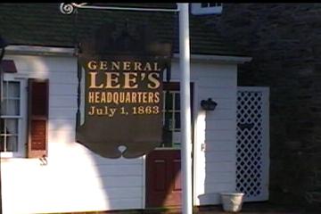 |
General Lee's Headquarters (now part of the hotel where we stayed) |
The balance of our trip was spent enjoying friends & family as we
went first to New Philadelphia, OH; then back to our former home, Chicago; and
finally went to Oklahoma City. While
we didn’t approach any major sights at these venues, we had a blast enjoying
time spent with others!