

NOTE: "HOME" takes you to our
initial home page; "UP" will return you
to the Chile 2005 site
for more exploring.
After fishing at Martin Pescador Lodge, we flew to Calama in the northern regions of Chile. Our quest here was to experience the Atacama Desert, one of the driest places on earth. It was also our last outing in Chile prior to returning home to New Mexico.
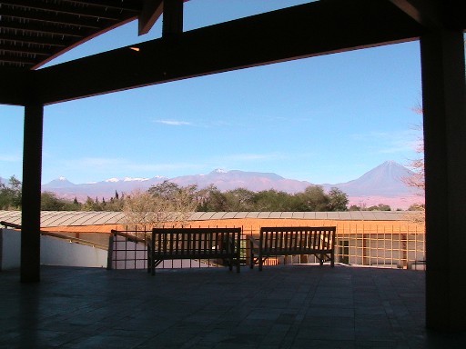
DAY 1 (Monday, March 28): This morning we were picked at our hotel in Calama by our host, Explora Atacama (yes, a sister lodge to Explora Patagonia). Explora Atacama too is an upscale facility located near the small town of San Pedro de Atacama, which itself borders an oasis. Explora Atacama sits at over 8,000 feet above sea level so some guests take a while to adjust to the altitude. Fortunately, since we live at 6,500 feet, we weren’t affected. Explora offers guests excellent opportunities for hiking, photography, horseback riding or just relaxing (www.explora.com). The ride from Calama to the lodge took about 1.5 hours and again we met new companions en route there.
Click on the image to display a larger photo. Once
displayed, click
on the BACK button (first button on the left of your browser)
to return to this page.
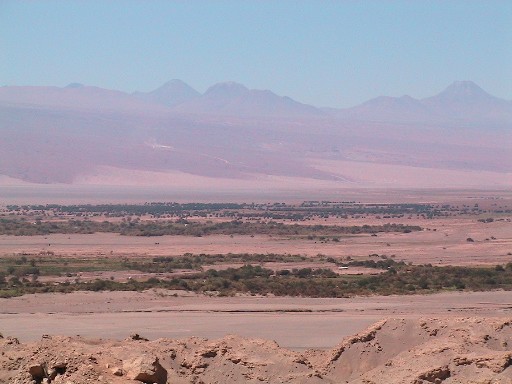 |
The oasis of San Pedro de Atacama |
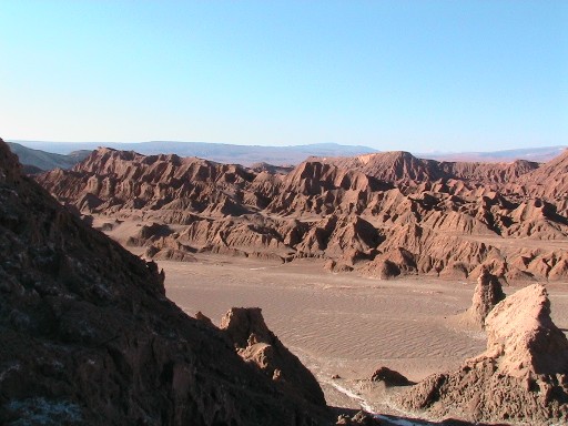
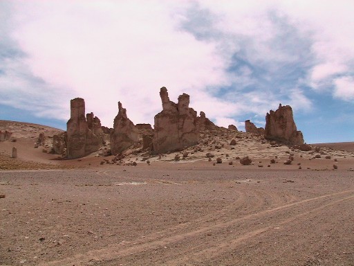
After enjoying a leisurely lunch, we went on an afternoon hike to Valle de la Luna (Valley of the Moon). It is such a stark setting that you really do feel like you must have visited the moon!
Click on the image to display a larger photo. Once
displayed, click
on the BACK button (first button on the left of your browser)
to return to this page.
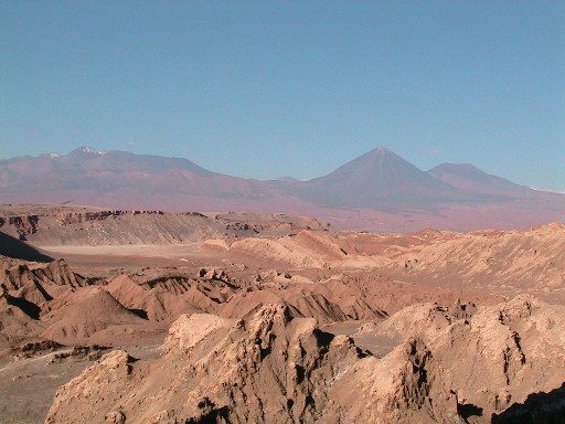 |
Our initial view of Valle de la Luna |
 |
Hiking in this arid region |
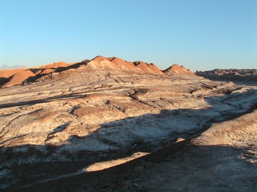 |
Another view with shadows adding to the illusion of being on the moon |
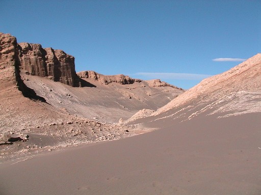 |
It looks like a river of sand
tall against the mesas |
Following our hike we returned to the lodge to enjoy drinks at the bar followed by a delicious dinner.
DAY 2 (Tuesday, March 29): This morning we took a hike into Cari Canyon. It’s known for amazing crystalline salt formations and pools.
Click on the image to display a larger photo. Once
displayed, click
on the BACK button (first button on the left of your browser)
to return to this page.
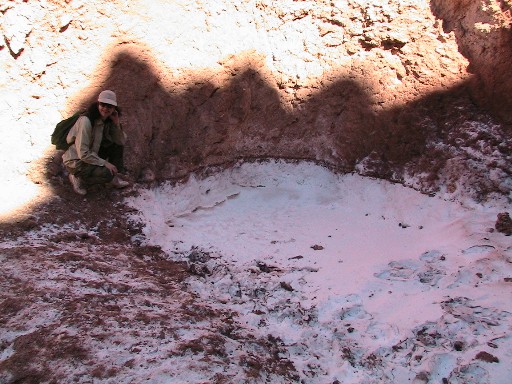 |
Lindy by a Cari Canyon "bath tub" |
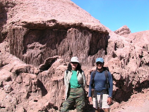 |
Lindy and guide, Ramundo, by crystalline salt formations |
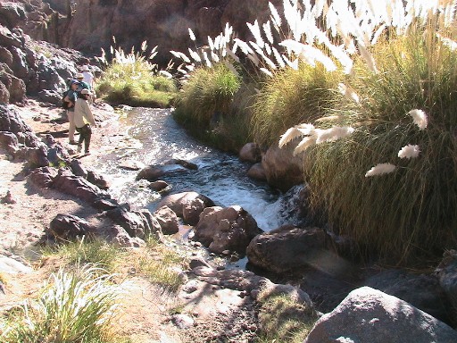
After returning to the lodge for a relaxing lunch, we then went hiking on Guatin (the “River Walk”). Amazingly, we actually did hike along a river in the desert. There was an abundance of cactus as well as fields of pompass grass.
Click on the image to display a larger photo. Once
displayed, click
on the BACK button (first button on the left of your browser)
to return to this page.
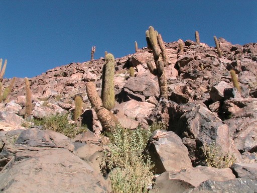 |
Guatin Cactus |
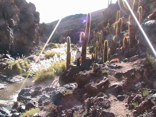 |
Ed amongst the cactus on the trail |
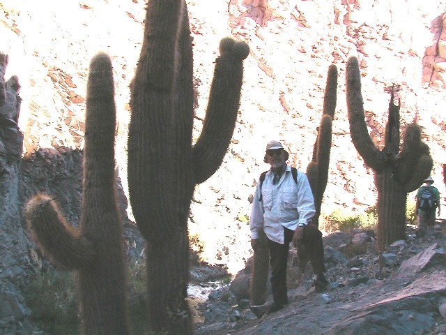 |
You can see how big these guys are! |
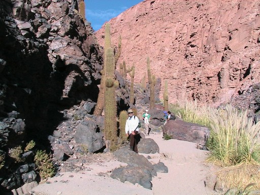 |
We're now deep in the canyon |
 |
The trail alongside the river deep in the canyon |
 |
Pompass grass hiding the trail |
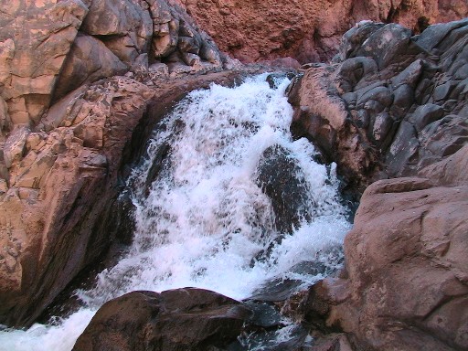 |
A small waterfall on the river |
Today when we returned to the lodge we took some time to enjoy one of the four swimming pools found on the property. It was a nice way to unwind before enjoying another great dinner.
Click on the image to display a larger photo. Once
displayed, click
on the BACK button (first button on the left of your browser)
to return to this page.
 |
Adobe walls
used for separating |
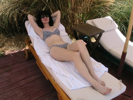 |
Relaxing by the pool |
 |
A late afternoon view from one of the lodge's decks |
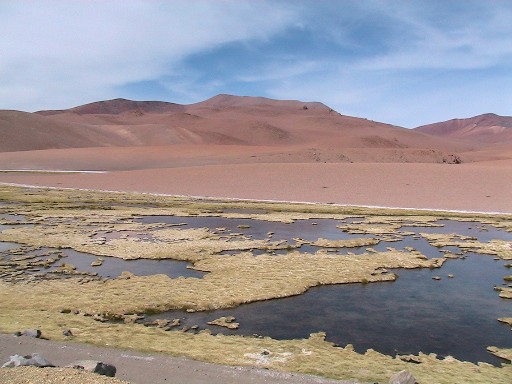
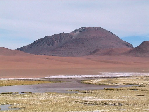
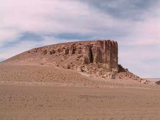
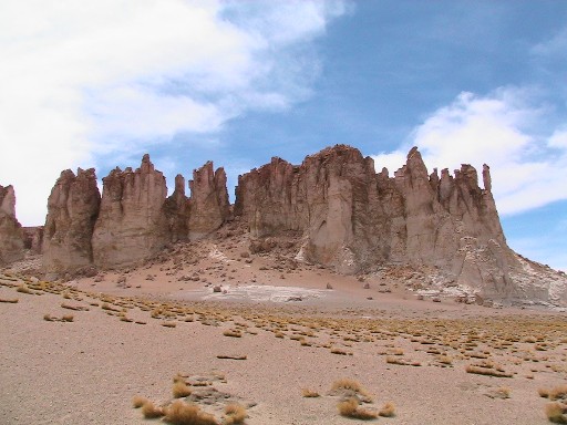
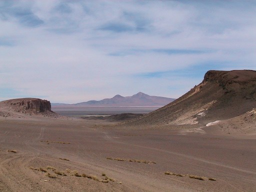
DAY 3 (Wednesday, March 30): Today we went on a driving tour to an area called Salar de Tara. We were very close to the Bolivian border on a high plain at some 15,000 feet above sea level. The views were probably the most amazing of the trip. We also saw lots of wildlife, including flamingos and vicunas. We spent the entire day exploring this area. We enjoyed a gourmet picnic lunch that was especially nice in this beautiful place.
Click on the image to display a larger photo. Once
displayed, click
on the BACK button (first button on the left of your browser)
to return to this page.
 |
Our first view of this area |
 |
Another perspective |
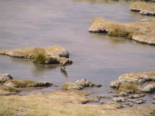 |
Look carefully - the lake is frozen as you can tell by the duck walking upon it (remember the altitude) |
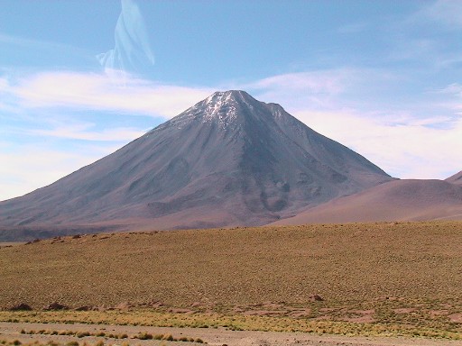 |
A volcano rising from this high plain |
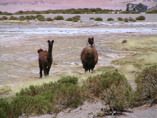 |
A couple of llamas |
 |
The formations of the area |
 |
Another view |
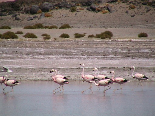 |
Pink flamingos in the area |
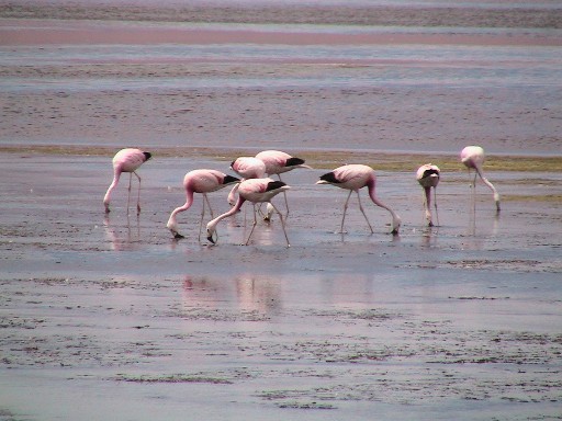 |
This flock is too busy eating to notice us |
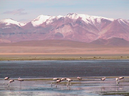 |
The incredible setting in
which these flamingos live |
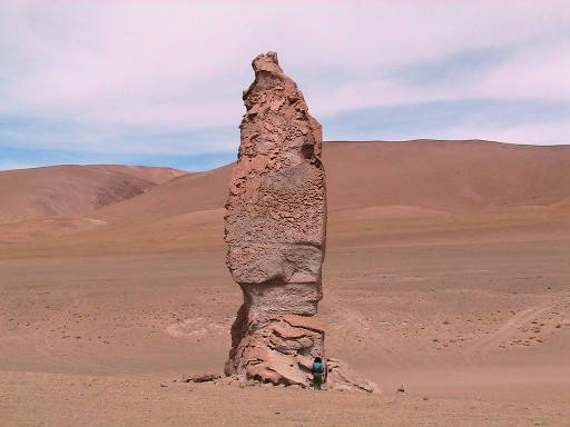 |
Lindy standing by a volcanic neck |
 |
A field of these volcanic necks |
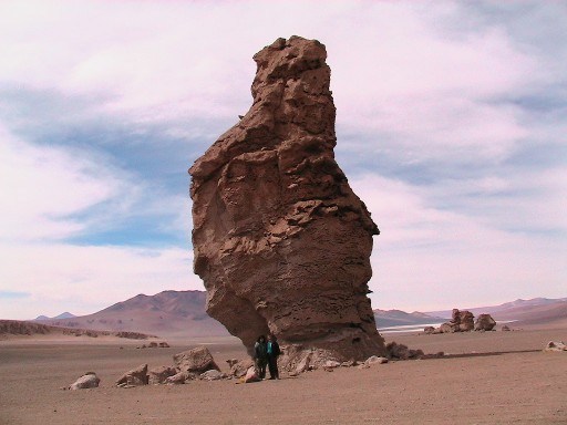 |
Another close-up view with us standing in front of the volcanic neck |
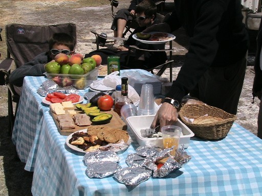 |
Our gourmet picnic |
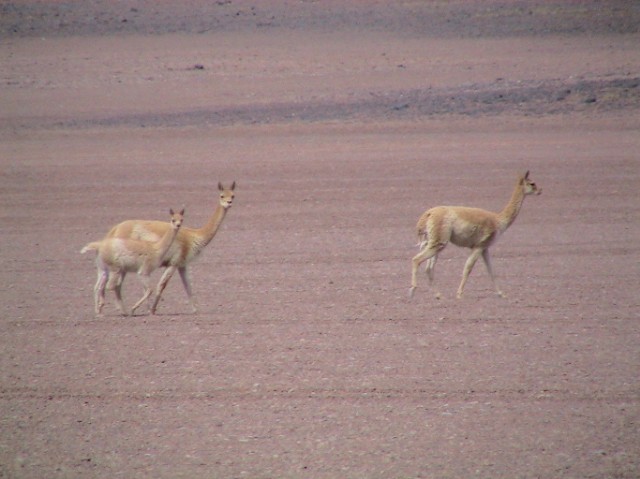 |
A small group of vicunas |
 |
Another vista |
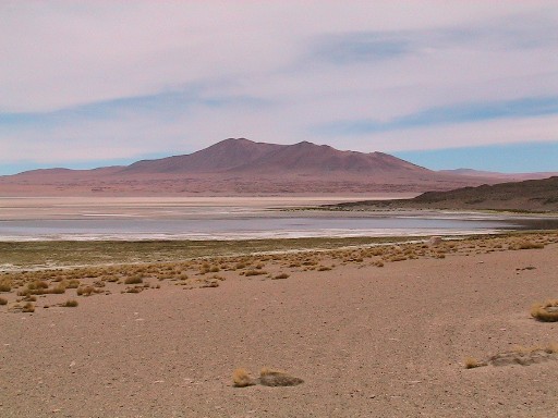 |
Again, we find water in this amazing place |
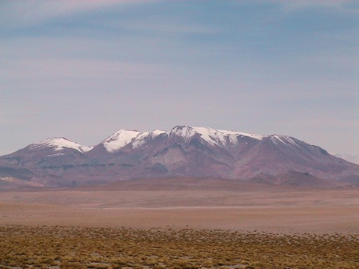 |
The snow capped Andes |
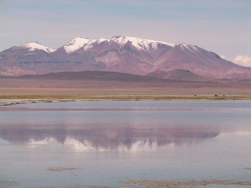 |
A beautiful reflection of the mountains and sky in the lake |
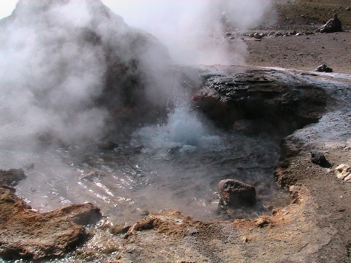
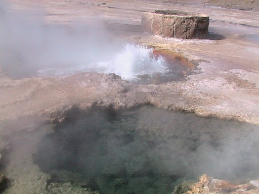
DAY 4 (Thursday, March 31): Again, we opted for a driving tour. We visited Pumitana Hot Springs with its many geysers and mud pots. We then did some pretty rugged hiking at well at over 12,000 feet. We enjoyed its views, the experience and the wildlife that we saw. Once we returned to the lodge, we did a late farewell dinner (~10:00PM) with companions we met throughout our stay.
on the BACK button (first button on the left of your browser)
to return to this page.
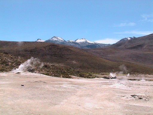 |
The Pumitana Geyser field |
 |
A view across the geyser field |
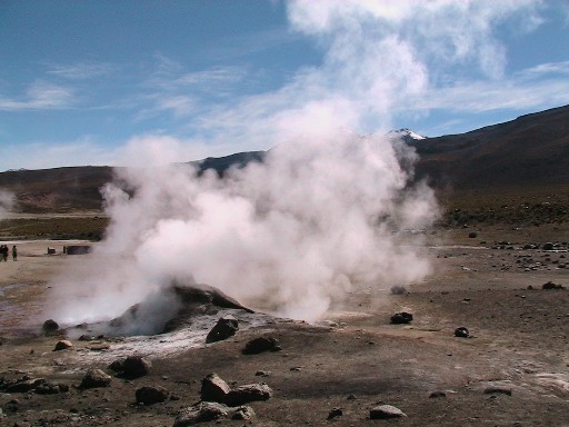 |
A view of one of the geysers |
 |
A close-up view with the Andes in the background |
 |
A view as the geyser begins |
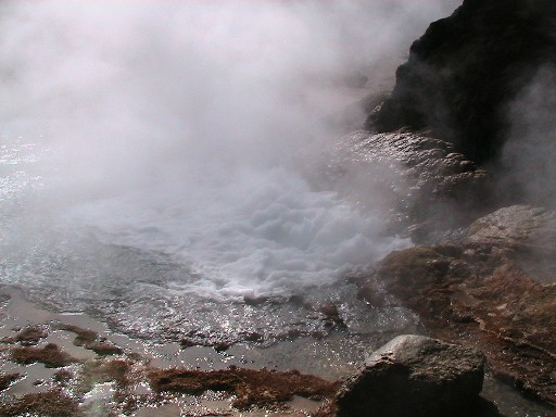 |
The water boiling in this geyser |
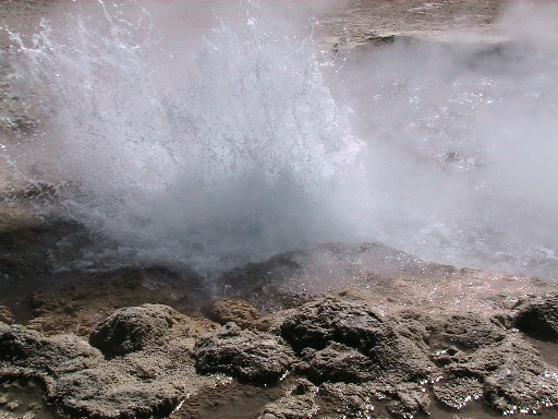 |
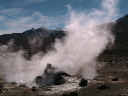
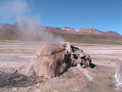
A geyser erupting |
 |
Another geyser erupting |
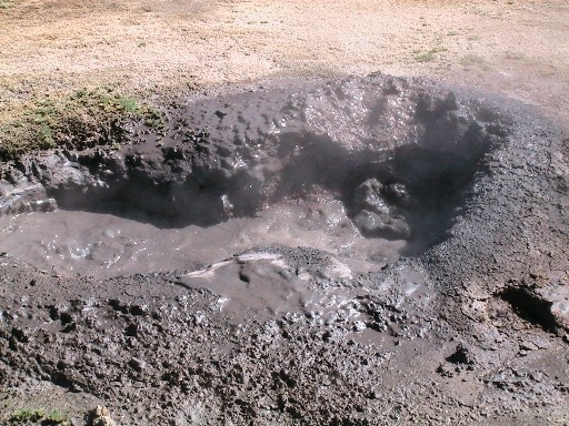 |
A mud pot bubble away |
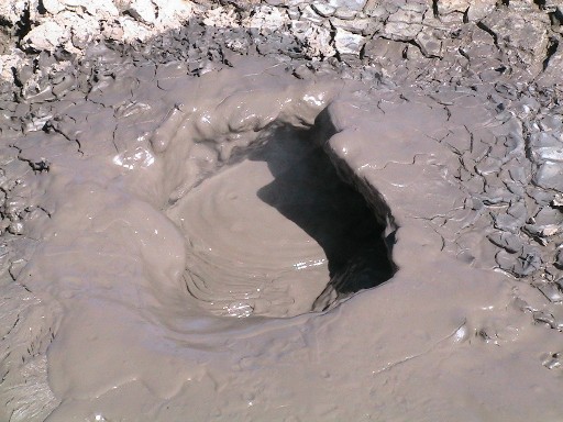 |
A closer look at a mud pot |
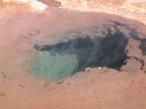 |
A beautiful heated pool |
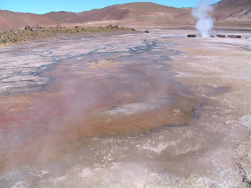
 |
A steam vent where minerals have deposited |
 |
Hiking on a trail near the geyser field |
 |
A well disguised Rhea (bird) in the center of the photograph |
 |
A lone vicuna |
 |
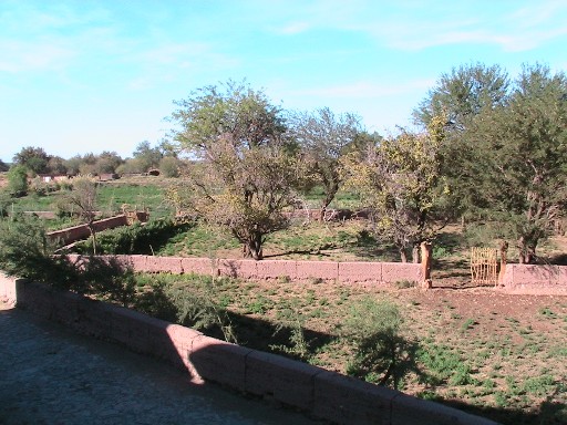
A small village in the area |
DAY 5 (Friday, April 1): This was our departure day from the lodge as well as the day we would begin our trek back to the U.S. However, we did have time in the morning to take a tour of San Pedro. We went to an excellent museum that outlined the history, culture, anthropology and geology of the area. The current town of San Pedro was established in 1540 by Pedro de Valdivia. Then, we went to a historic fort which predates San Pedro. The walls and some buildings remain partially intact. It was quite fascinating! Afterwards, we enjoyed a final lunch at Explora Atacama and then returned to Calama for our flight to Santiago and then onto the U.S.
on the BACK button (first button on the left of your browser)
to return to this page.
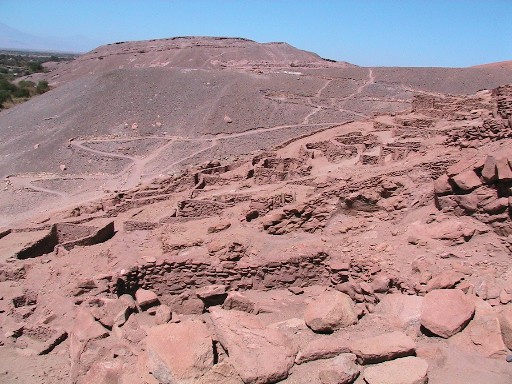 |
A view of ancient San Pedro |
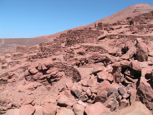 |
There are many structures and
walls which remain intact |
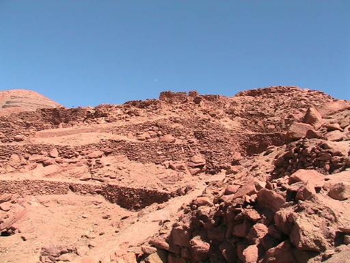 |
A final view of ancient San Pedro |
In closing, we truly enjoyed spending time in this unique and striking environment. It was beautiful and awe-inspiring. We had an incredible time with many terrific memories. Explora Atacama was an excellent base to explore this magical place.