CANADA & NORTHWEST USA TOURING '08
![]()
![]()
![]()
NOTE: "HOME" takes you to our initial home page; "UP" will return you
to the North America site
for more exploring.
We headed north to Canada beginning on Tuesday, 3 June. When we reached Colorado Springs, we hit rain that didn’t end for days. For the most part it was manageable (except for a hail storm outside Colorado Springs which forced us to delay our travels a bit). Otherwise it made for a cool drive into the province of Saskatchewan.
We arrived in Saskatoon on 6 June in anticipation of the primary reason for our visit to the province – to enjoy the celebration of the wedding of our friends, Becky & Evan. The ceremony took place at Saskatoon’s United Church at 5:00PM the following evening. It was a beautiful ceremony followed by a wonderful cocktail/dinner event. There we spent time with Mary, Becky’s mother, whom we have known for many years since our fishing days at Selwyn Lake Lodge. We also met many of Becky’s other relatives (her grandmother, Victoria; her uncle, aunts, etc.). Then we also got to meet Evan’s parents (Ed & Gloria) for the first-time. We know we’ll have time to get to know both families even better since Becky & Evan live in Albuquerque about 15 miles from our place in Cedar Crest.
Click on the image to display a larger photo. Once
displayed, click on the BACK button (first button on the
left of your browser) to return to this page.
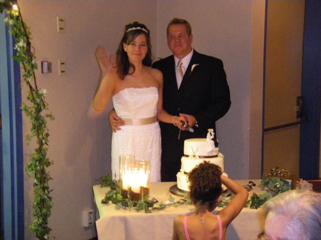 |
The bridge & groom cutting the cake |
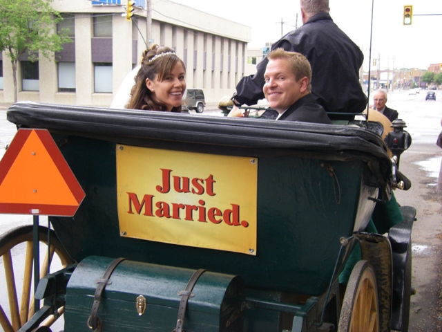 |
Becky & Evan leaving the church |
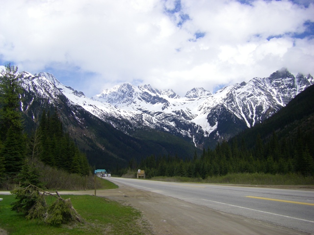
Following the wedding, we headed West across Canada (again, driving in the rain; we’re starting to feel a bit like Joe Bflipz – the cartoon character with the cloud over his head). We spent our first night in Calgary (yes, home of the Calgary Stampede in July). Next, we drove through Banff National Park and Glacier National Park. They are both incredibly beautiful! The mountains are still covered with lots and lots of snow and, at the passes, the snow was along side the road. We arrived in Kamloops in the early evening after enjoying a very special drive.
Click on the image to display a larger photo. Once
displayed, click on the BACK button (first button on the
left of your browser) to return to this page.
 |
A stream flowing in Banff National Park |
|
|
The majestic setting of Banff National Park |
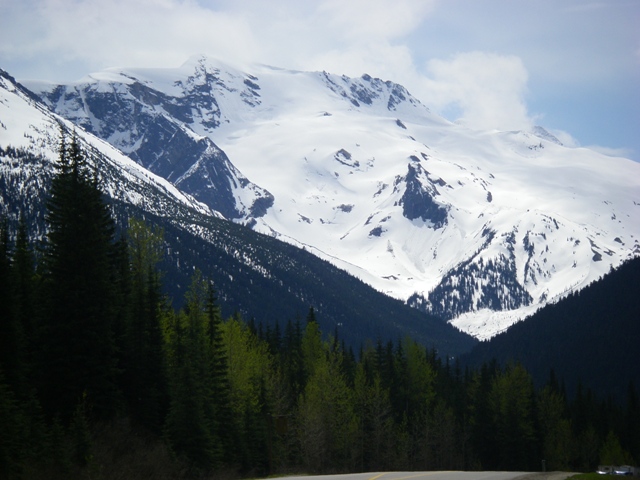 |
The high mountains in Glacier National Park |
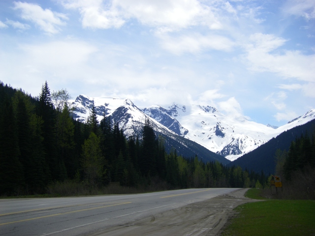 |
Another view of Glacier
National Park - not too many other cars on the road |
On 10 June we headed to Vancouver, British Columbia. Again, the day began with light showers. However, en route (between Merritt, BC and Hope, BC) we encountered heavy snow showers. Yes, that’s right; snow in June! Thankfully, it didn’t stick to the roadway but it did to everything else (trees, ground, railings). It finally gave way to more rain as we once again hit lower elevations. We arrived at our hotel in the suburbs (Coquitlam) late afternoon and made our plans for the next day’s touring in Vancouver.
On 11 June, we left our car at the hotel and took the “SkyTrain,” Vancouver’s mass transit rail, into downtown. From there, we walked to Stanley Park where we visited Vancouver’s Aquarium. We spent the day looking at the fabulous exhibits if offers. We had the extreme pleasure of viewing a baby beluga whale which was born the evening before we arrived (10 June at 4:28PM) to Qila. The baby was less then 18 hours old when we first saw it. It was amazing to watch the pair swim and then see the mother whale allow the baby to nurse. Other highlights included the dolphin training, otter feeding and the B.C. fisheries exhibit.
Click on the image to display a larger photo. Once
displayed, click on the BACK button (first button on the
left of your browser) to return to this page.
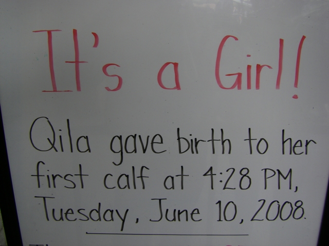 |
The sign announcing the birth of Qila's baby |
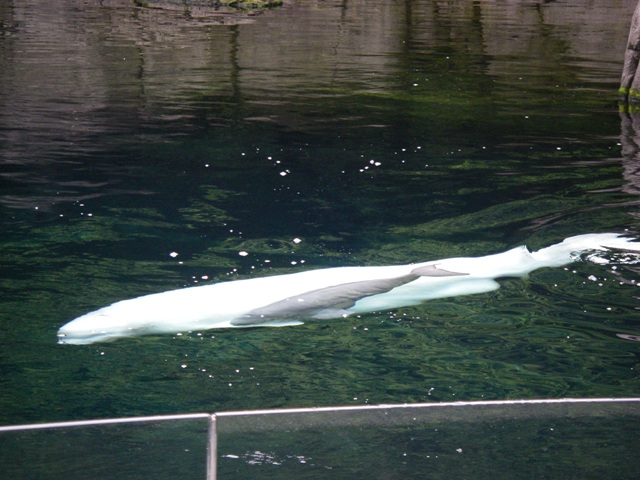 |
Qila allows her baby swim together |
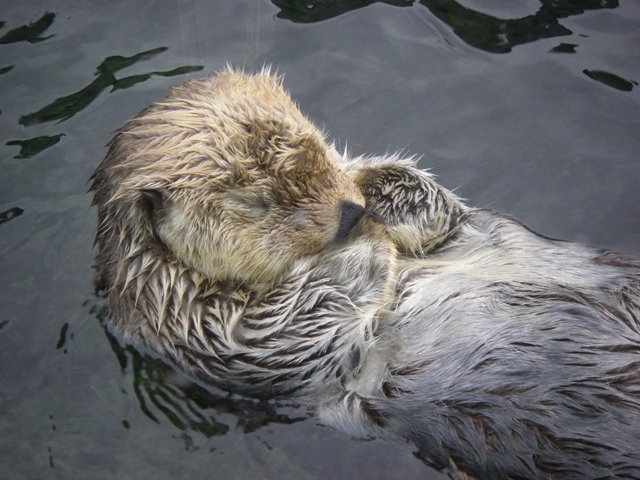 |
An otter takes an afternoon nap |
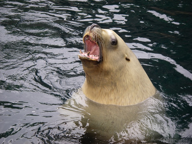 |
This stellar sea lion was talking to us! |
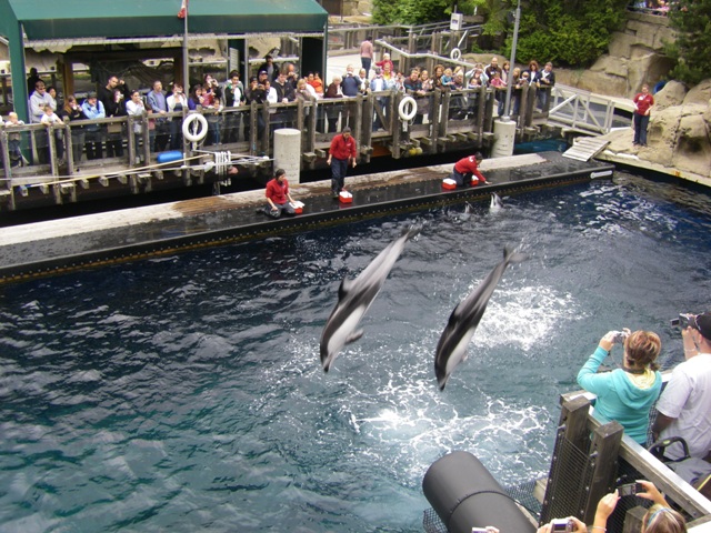 |
The amazing dolphins in action |
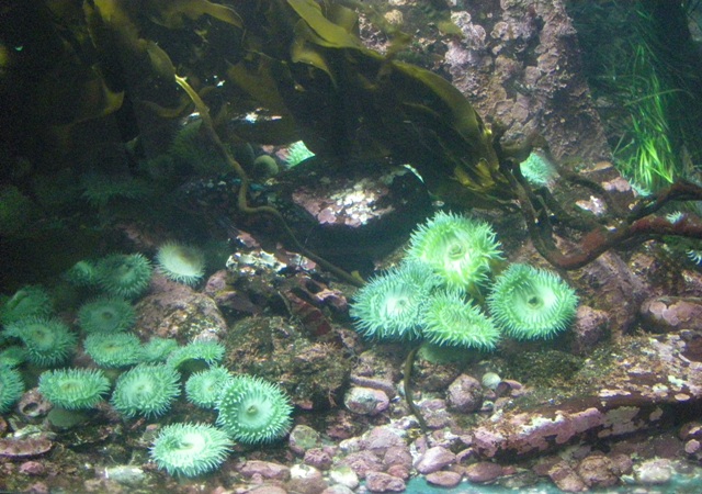 |
Beautiful green anemone in the B.C. fisheries exhibit |
For our final day in Vancouver, we once again took the SkyTrain into town. We began at the waterfront area where the cruise lines dock while passengers explore Vancouver. Then, we walked through the old Gas Lamp district and China Town. We actually had some semi-cloudy weather which was a real treat since it was our first day without rain or drizzle. We returned to our hotel late afternoon to prepare for our return to the States for a couple of days before heading to Vancouver Island to do some more exploring in Canada.
Click on the image to display a larger photo. Once
displayed, click on the BACK button (first button on the
left of your browser) to return to this page.
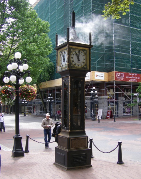 |
A steam clock still in use today |
 |
A view from the Gaslight District |
On 13 June, we drove from Vancouver to Whidbey Island, Washington. It was a beautiful drive despite clouds and a bit of rain. We arrived on the island late afternoon and settled in. We now know why coffee is so popular in Washington. You really need it to stay warm (even in June!).
We woke up to a beautiful morning on June 14 so we went exploring the State Parks located on the south of Whidbey Island. First, we went to Fort Casey State Park. Fort Casey was a coast artillery site guarding the entry to Puget Sound in the early 1900’s. Two historic guns remain on site as well as the concrete fortifications. It’s a pretty amazing site. This park also houses the Admiralty Head Lighthouse which was built in 1858. Then, we headed to Fort Ebey State Park. This fort was built in 1942 as part of the World War II defensive build-up. Only a few remnants of the fort remain but the park offers great views of the Strait of Juan de Fuca. The really amazing part of the day was that we enjoyed sunshine!! Something we haven’t seen except for the day we drove through Banff National Park and Glacier National Park. Very, very nice!
Click on the image to display a larger photo. Once
displayed, click on the BACK button (first button on the
left of your browser) to return to this page.
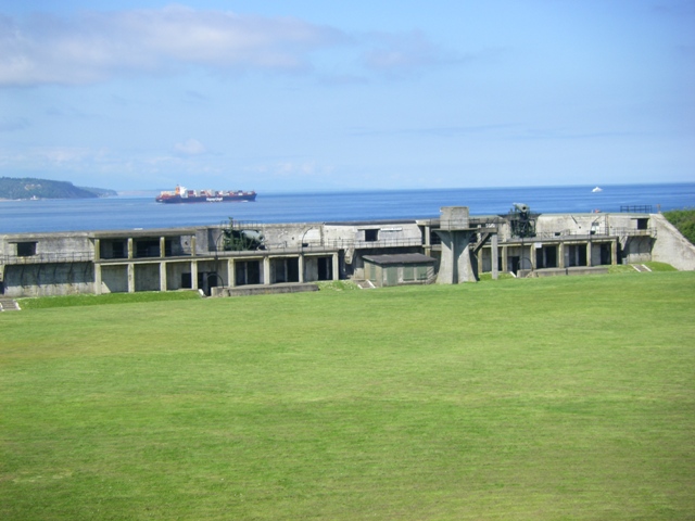 |
An overview of Fort Casey with a ship in the sea beyond the State Park |
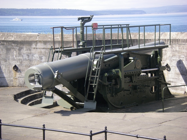 |
One of the guns used in Fort Casey |
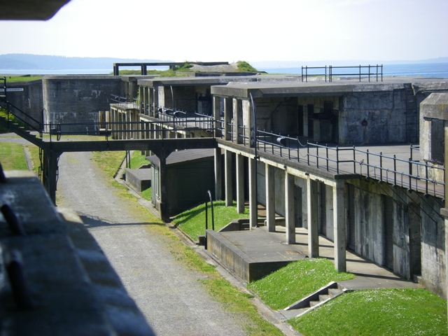 |
Another view of the Fort's embattlements |
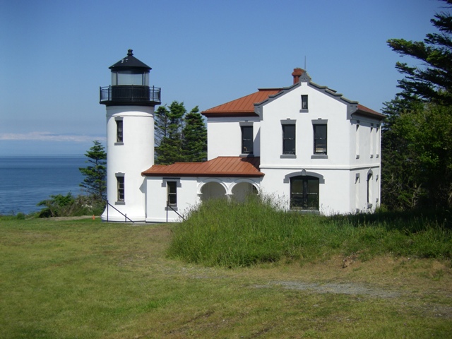 |
The Admiralty Head Lighthouse built in 1858 |
 |
A view of the Strait of Juan
de Fuca as seen from Fort Ebey State Park |
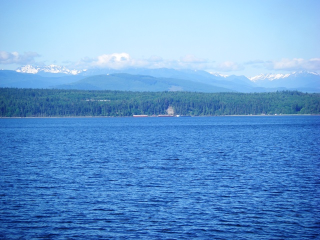
On 15 June, we left Whidbey Island via the Washington State Ferry. Since we had a fairly clear day, we were able to enjoy our first views of the Olympic Mountains during the 30 minute ride. We arrived on the mainland mid-morning and proceeded on to Port Angeles, our departure point for the ferry to Vancouver Island the following day. We settled into our beautiful hotel and enjoyed additional views of the mountains and the sea.
Click on the image to display a larger photo. Once
displayed, click on the BACK button (first button on the
left of your browser) to return to this page.
 |
A view of the Olympic
Mountains from the Washington State Ferry |
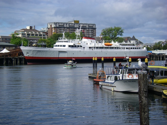
On 16 June, we once again hit the sea. This time we returned to British Columbia and, in particular, to Vancouver Island. After loading vehicles into the ship’s hull, the journey aboard the ferry, MV CoHo, took about 90 minutes. Despite rough seas, the ride went very smoothly. We arrived in the city of Victoria mid-afternoon. We found our hotel without difficulty. Then, we went out for a bit of shopping.
Click on the image to display a larger photo. Once
displayed, click on the BACK button (first button on the
left of your browser) to return to this page.
 |
The M/V Coho sitting in port |
On 17 June, we first went to the wharf area where we had great views of the sea as well as the Parliament Building and the famous Empress Hotel. It was a beautiful day – still cool but with some welcome sunshine.
Click on the image to display a larger photo. Once
displayed, click on the BACK button (first button on the
left of your browser) to return to this page.
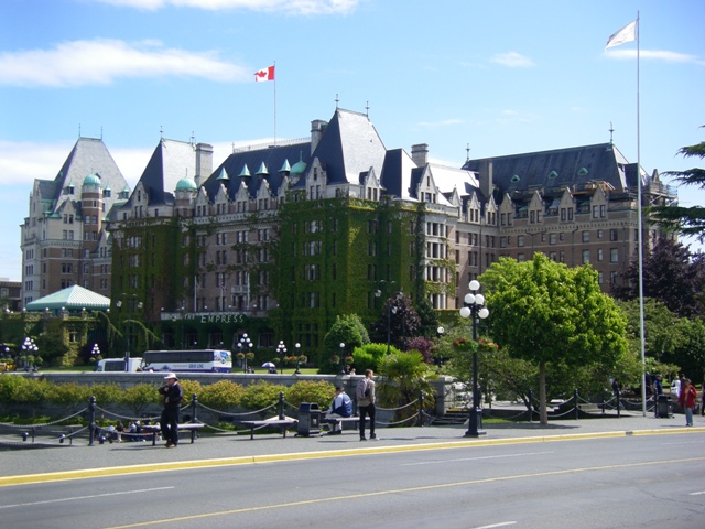 |
The classic Empress Hotel |
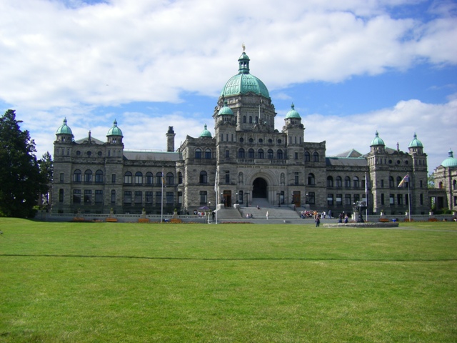 |
The Parliament Building |
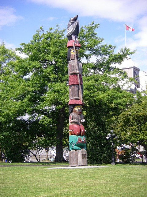 |
The "Knowledge" Totem Pole located on the Parliament grounds |
After taking photographs in the area, we went to The Royal BC Museum. What a treat! The museum had wonderful exhibits covering every aspect of life in the province as well as the aboriginal heritage of the area. It also had some incredible diorama’s – some of the best we’ve ever seen! After spending many hours wandering the exhibits, we finished the day with an IMAX movie called “Wild Coast.” It was about marine life off the southeast coast of Africa. It too was excellent and it was great to learn at the end of the film that part of the southeastern African coast now has become a marine sanctuary.
Click on the image to display a larger photo. Once
displayed, click on the BACK button (first button on the
left of your browser) to return to this page.
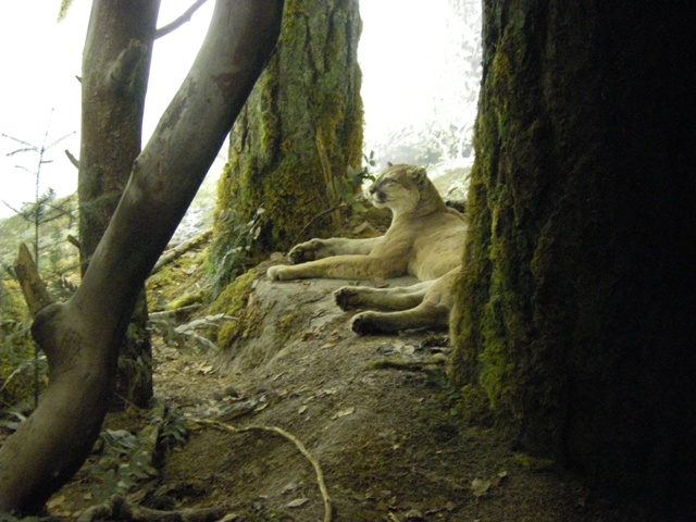 |
This diorama features a cougar (it looks so real!) |
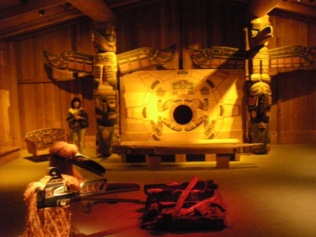 |
This is a house of the Kwakjutl people |
 |
Here's a close-up of the totem on the right of the house |
 |
A diorama of featuring ocean birds on a sea cliff |
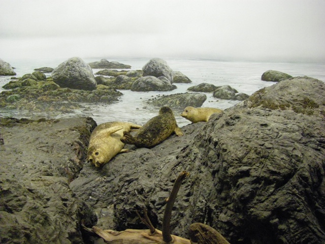 |
Again, it's hard to believe
these aren't live seals instead of a diorama |
We were once again on the road on 18 June. We headed north to our destination of Campbell River. En route we stopped at Duncan, a city known for its many totem poles. We arrived in Campbell River mid-afternoon and settled into our hotel overlooking the sea. Since we had a kitchen, we asked the front desk personnel about buying fresh seafood in the area. They sent us to a spot on the pier (Crabby Dave's). Dave had tanks of live crabs caught in the ocean between the B.C. Mainland and Vancouver Island as well as local clams, mussels, halibut, salmon, etc. We purchased one of the biggest Dungeness crabs we ever had – it was over three lbs. Then we purchased clams and Ed made a red sauce using both. It was fabulous. We ate the sauce and clams over pasta and had the crab left-over for the next night’s meal. A double treat!!
Click on the image to display a larger photo. Once
displayed, click on the BACK button (first button on the
left of your browser) to return to this page.
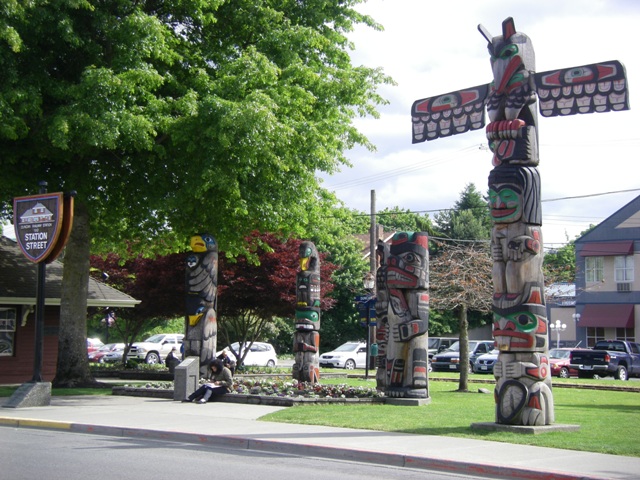 |
Some of the totem poles found in Duncan |
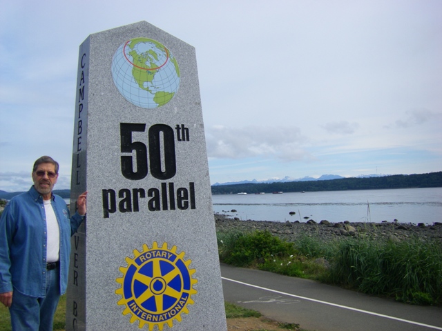 |
Ed standing next to the
Campbell River 50th parallel marker |
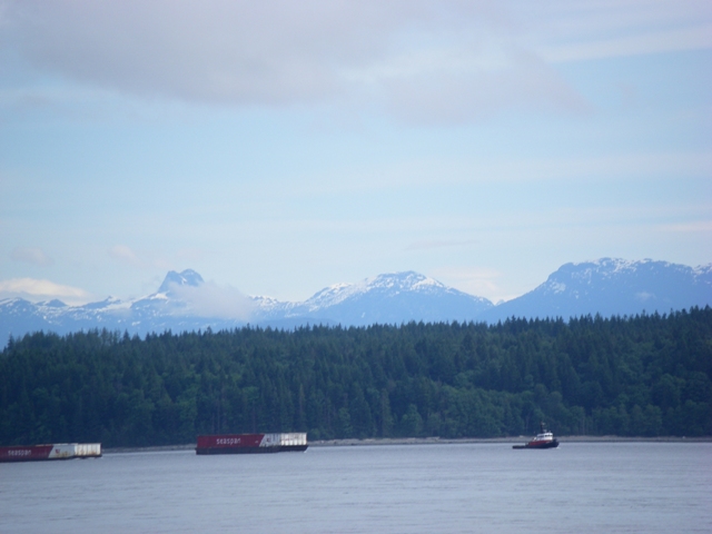 |
The tug boats and peaks of Campbell River |
The 19th of June was another cloudy, misty day. However, we weathered the elements and headed to Strathcona Park. There we drove around the numerous lakes and got some views of the snow-capped mountains hidden in the clouds. Despite the dreary weather, the setting will very pristine and still beautiful.
Click on the image to display a larger photo. Once
displayed, click on the BACK button (first button on the
left of your browser) to return to this page.
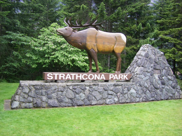 |
The entry to the park |
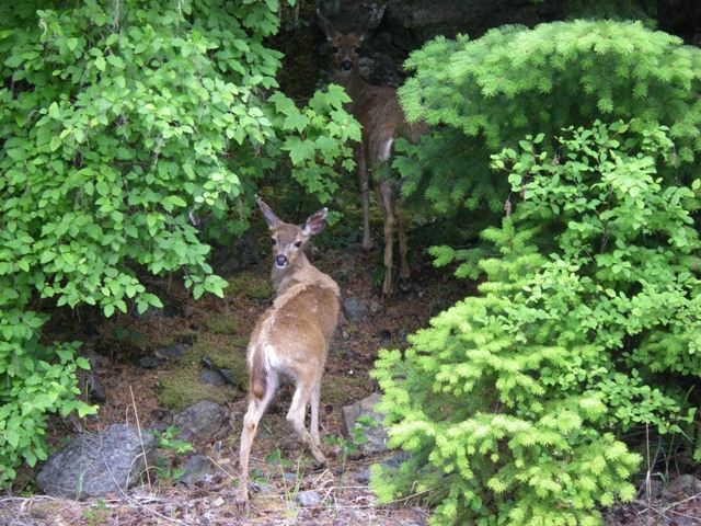 |
A couple of deer watching us as we approach them |
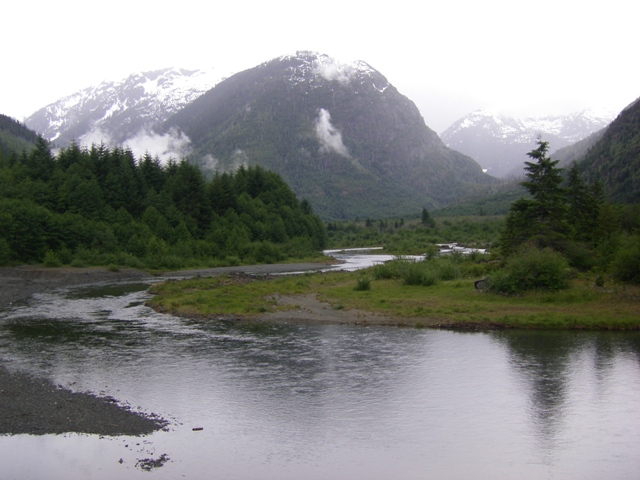 |
A beautiful and mystical view of Thelwood Creek |
On the 20th & 21st of June we continued our trek north on Vancouver Island. We spent these days exploring the area in and around Port Hardy. Here the highway which runs the length of Vancouver Island ends. During our drives, we were lucky to see a black bear lumbering along the roadside. We weren’t able to get a photograph of that fellow. However, Ed managed a great shot of an eagle with a fish it had just caught. It was really spectacular!
Click on the image to display a larger photo. Once
displayed, click on the BACK button (first button on the
left of your browser) to return to this page.
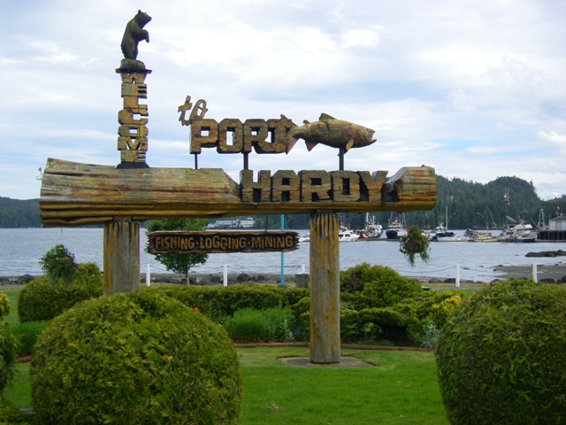 |
Wecome to Port Hardy, the end of the highway |
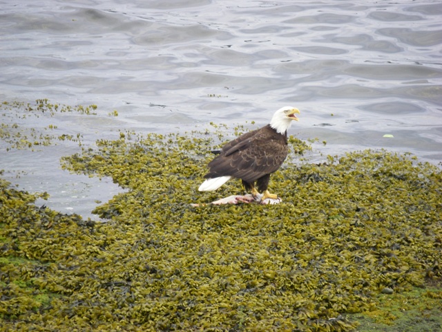 |
A spectacular shot of an eagle with a fish it just caught |
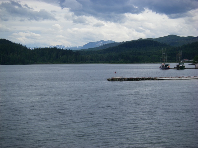 |
A view of Port Hardy's bay |
 |
A Great Blue Heron fishing in the bay |
On 22 June we returned to Victoria where our exploration of Vancouver Island began. Then, on the morning of 23 June we once again caught the MV CoHo ferry, this time going back to Port Angeles, Washington. From there we drove to Forks to begin our five day adventure of exploring Washington’s northwest coast and Olympic National Park.
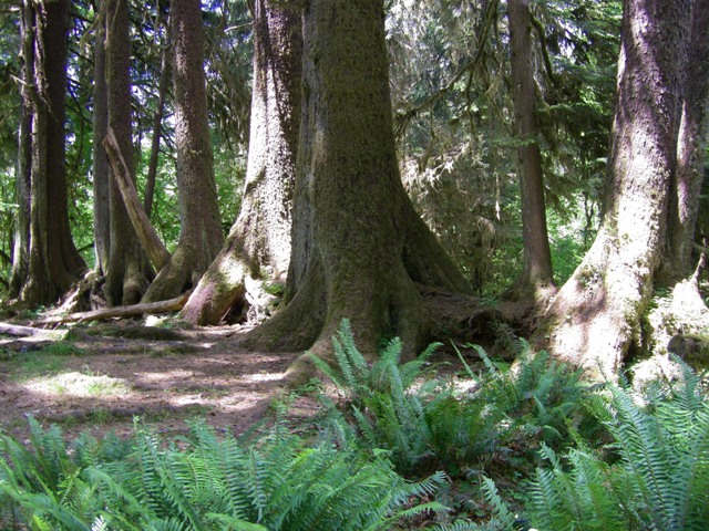
On 24 June we went into Olympic National Park. In particular, we visited the Hoh Rain Forest located south of Forks. This is an amazing combination of many trees and plants which thrive due to the average 140 inches of rainfall in addition to condensed mist that contributes another 30 inches of moisture annually. On trails near the Visitor Center, you see giant Sitka Spruce, Douglas Fir, maples and red alder, many draped with moss. Ferns are growing everywhere as are lots of other plants which make it difficult to even see the forest floor. We spent our time hiking the various trails on a very unusual day filled with lots of sunshine which you can see filtering through the forest in a few shots.
Click on the image to display a larger photo. Once
displayed, click on the BACK button (first button on the
left of your browser) to return to this page.
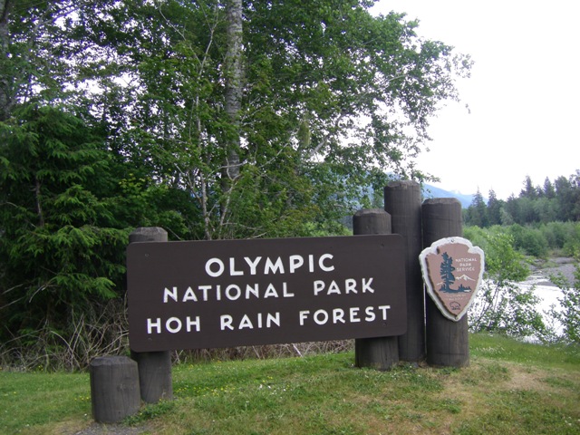 |
Welcome to the Hoh River! |
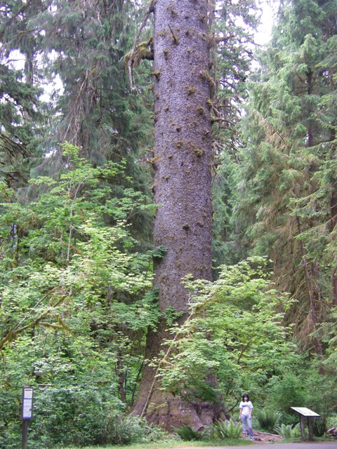 |
A giant Sitka Spruce along a trail |
|
|
Lindy by the giant Spruce (for perspective) |
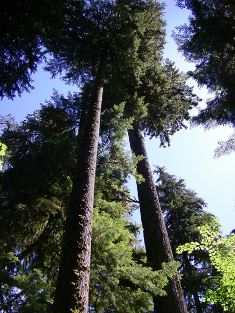 |
A view up through the canopy |
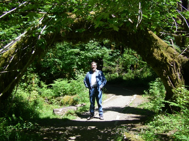 |
Ed beneath a live Maple Tree which grew across the trail |
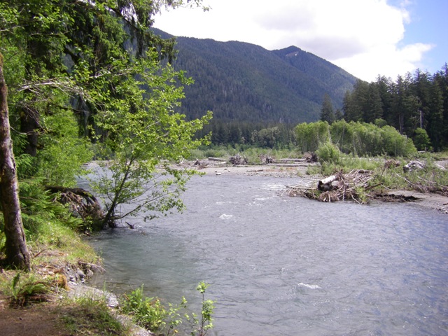 |
A view of the mighty Hoh River |
 |
A few of the ferns always nearby the giant forest trees |
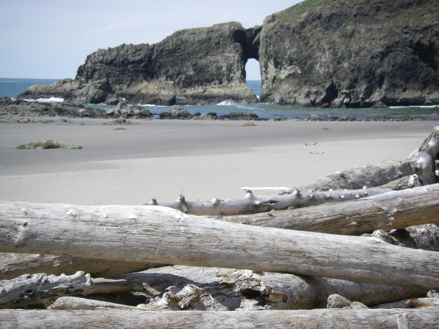
On 25 June we once again visited Olympic National Park. However, this time we headed west to the beaches now under Park protection. We first hiked about 2.5 miles along Rialto Beach to view the many beautiful vistas, including the “Hole-in-the-Wall.” Here you access the beach via a ramp walkway down to the shore where many logs have piled up. On the beach we saw some interesting sea creatures – a beautiful purple star fish and an aggregated sea anemone (we confirmed the species with a park ranger) which covers itself with small rocks and mud during low tide. Very fascinating.
Click on the image to display a larger photo. Once
displayed, click on the BACK button (first button on the
left of your browser) to return to this page.
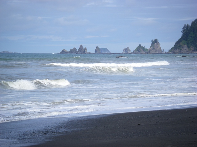 |
The waves coming into the beach |
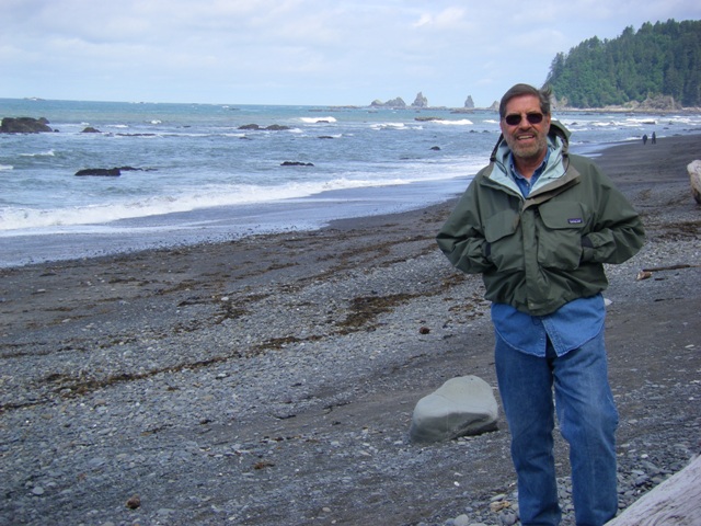 |
Ed on Rialto Beach (it's a bit breezy & cool) |
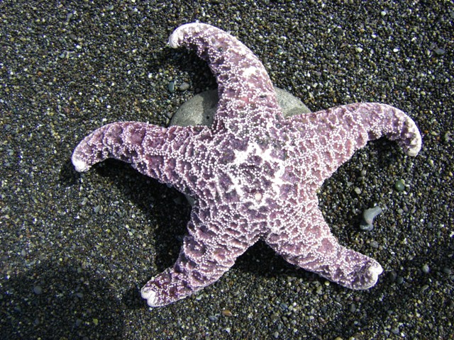 |
A purple star fish |
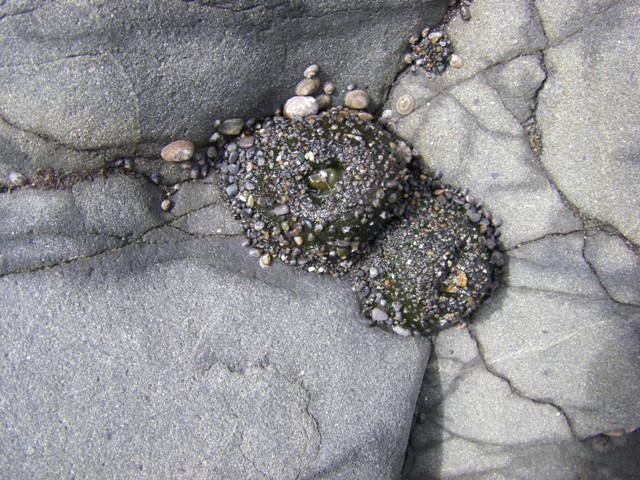 |
At first, we didn't realize
these creatures - aggregated sea anemone - were alive |
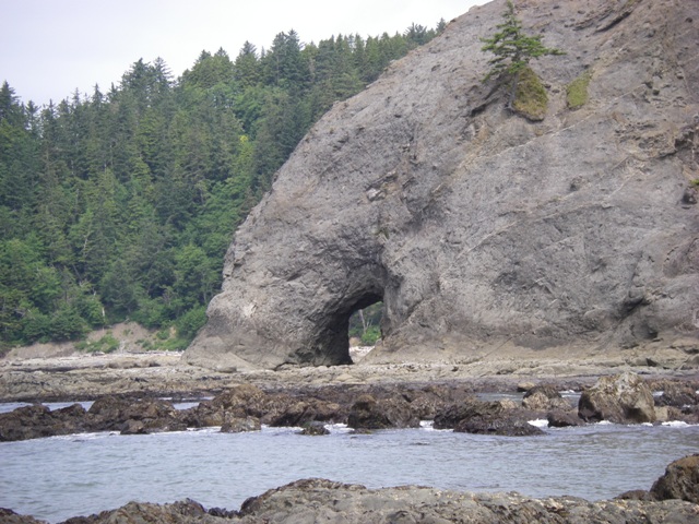 |
Railto's "Hole in the Wall" |
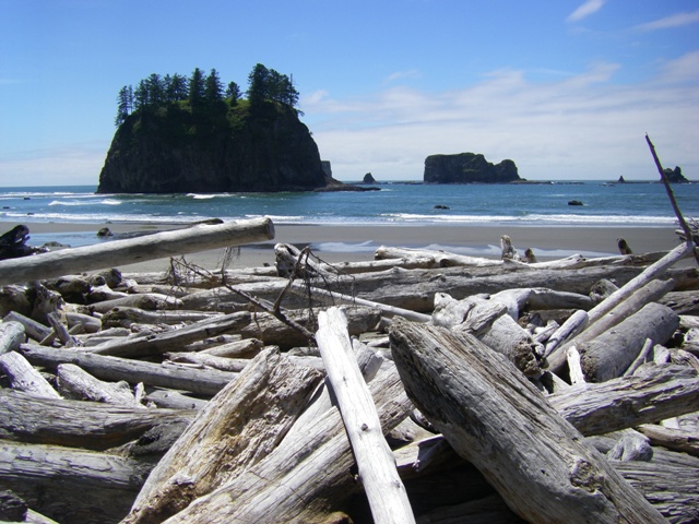
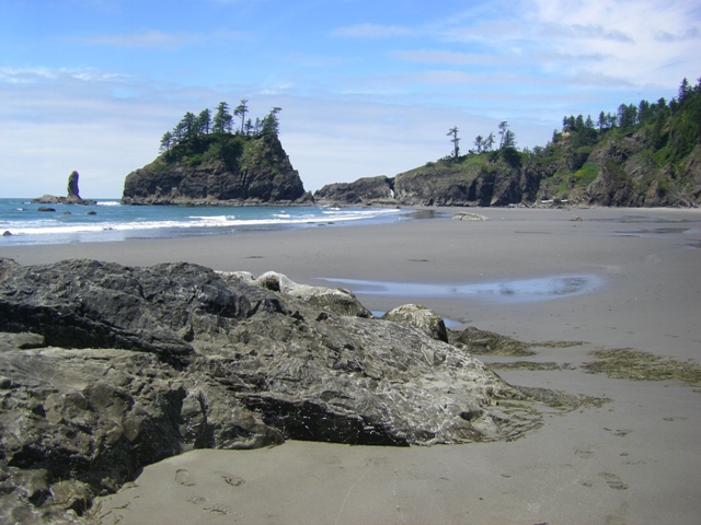
After Rialto Beach we went to the Quileute Indian township of La Push for a brief pause and some refreshments post-hike. Then, we made our way to Second Beach to do another hike. However, this time we had to hike up a small hill and then hike down a steep path through heavy forest before reaching the beach. Next we had to jump, crawl and wander through the logs at the base of the forest to reach the beach. It was very different from Rialto Beach in that we were virtually the only persons there. Also, it was a very smooth beach whereas Rialto was somewhat rocky. Interestingly, Second Beach too had a place where the sea had worked its way through a rock to form another hole formation.
Click on the image to display a larger photo. Once
displayed, click on the BACK button (first button on the
left of your browser) to return to this page.
 |
The obstacle course to accessing Second Beach |
 |
A view of the beach and, in
the distance, Second Beach's own "Hole in the Wall" |
 |
A closer view of the Hole in the Wall |
After leaving the beach and climbing back up the hill, we decided to call it a day and return to Forks before continuing our adventures tomorrow along the Western Washington seacoast.
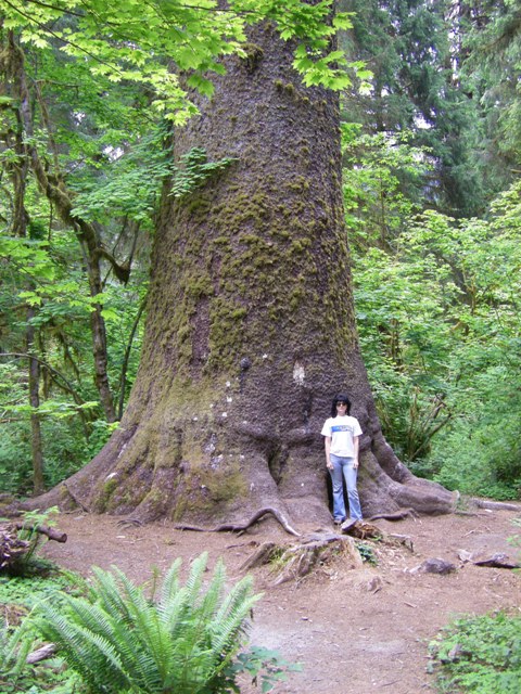
On 26 June we left the town of Forks with our destination for the next two nights being Ilwaco, Washington at the mouth of the Columbia River. En route, we once again visited spots in the Olympic National Park. In particular, we enjoyed a stop at Big Cedar, a huge cedar tree. We arrived in Ilwaco, a fishing port on Long Peninsula, at about 4:00PM and settled in for the night.
Click on the image to display a larger photo. Once
displayed, click on the BACK button (first button on the
left of your browser) to return to this page.
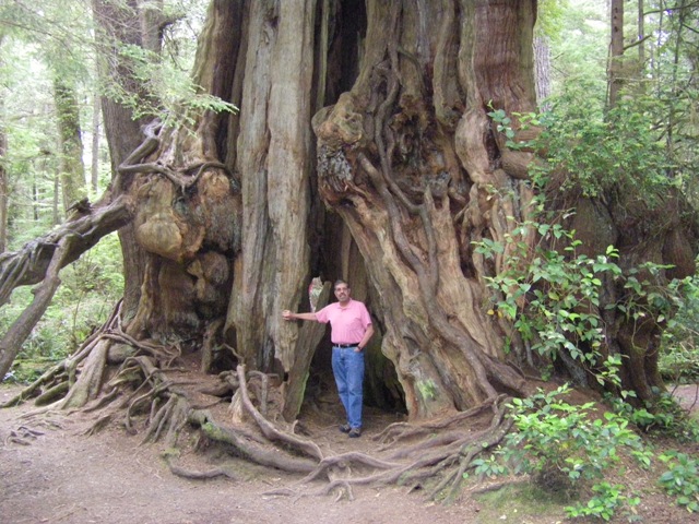 |
Ed standing by Big Cedar |
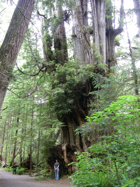 |
Another view with Lindy by this giant |
The following day we decided to explore the area in and around Ilwaco. We began the day by driving up to the tip of Long Peninsula to visit Leadbetter Point State Park. We arrived fairly early and had the place to ourselves. We took a 2.6 mile hike across the tip of the peninsula to reach the Pacific Ocean. The beach was beautiful and completely deserted. We could see a mile or two up and down the beach and there wasn’t a soul! We did a little beachcombing and we found quite a few large sand dollars in perfect condition. Next, we headed back to the Willipa Bay side of the peninsula to visit Oysterville. The town was founded in 1854 and, true to its name, the main economy was harvesting oysters. A few original town buildings such as the church and school are in excellent condition. The entire town as placed on the National Register of Historic Places in 1976. We then drove down back down the peninsula to visit North Head Lighthouse. The lighthouse was built in 1898 and remains in use today. Finally, we headed to the Port of Ilwaco. While there we found a wonderful operation where we bought smoked sturgeon and smoked oysters. Yum, yum!
Click on the image to display a larger photo. Once
displayed, click on the BACK button (first button on the
left of your browser) to return to this page.
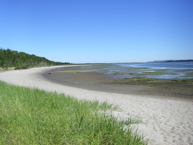 |
A view of the beach (our
private one) in Leadbetter State Park |
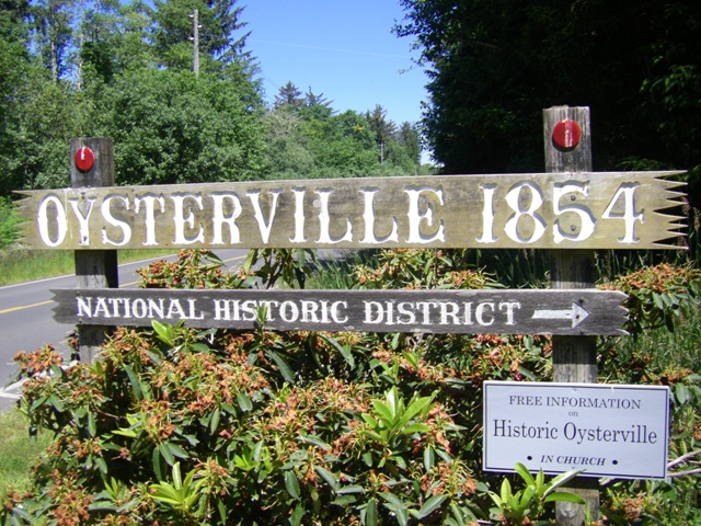 |
Welcome to Oysterville! |
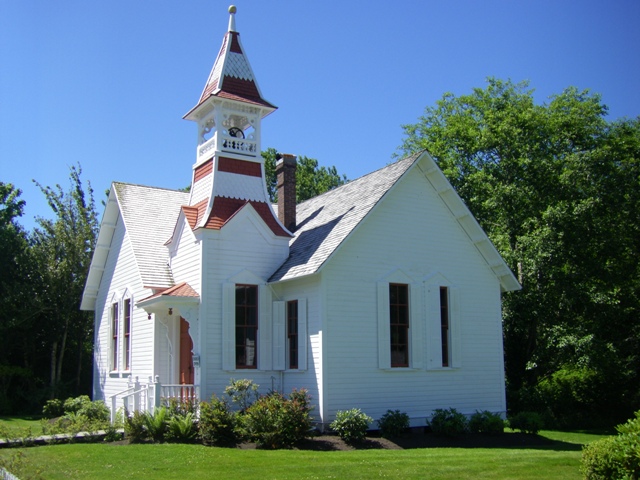 |
Oysterville's Church |
 |
The original school in Oysterville |
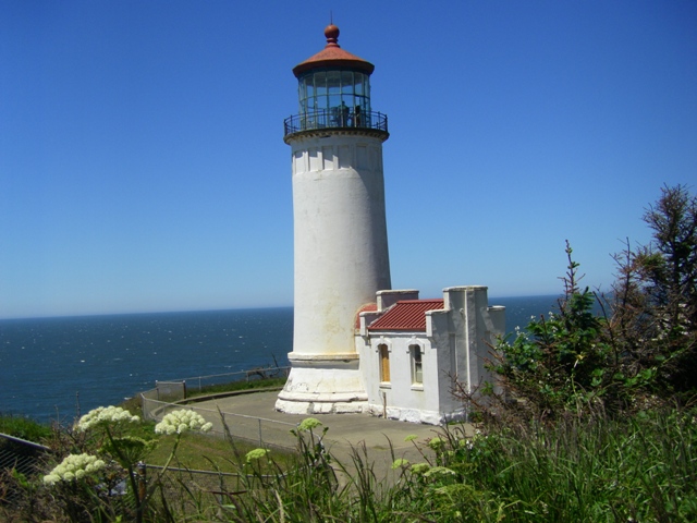 |
North Head Lighthouse |
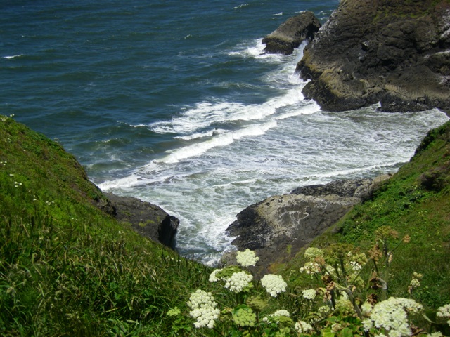 |
The view below the Lighthouse |
 |
A view down the beach from North Head Lighthouse |
On 28 June we drove to Seattle and spent the evening there. The following day we flew into Anchorage. Then, on 30 June we flew from Anchorage to King Salmon to begin our fly fishing week at No See Um Lodge. (see, NO SEE UM LODGE '08).
On 7th of July, we returned to Anchorage after another wonderful week at No See Um Lodge. The next day we flew to Seattle to retrieve our car and begin the trek home.
On 8 July, we left Seattle to head to La Pine, Oregon. En route, we were through the Mt. Hood National Forest. It was bright and sunny and we were very lucky to get some great views of Mt. Hood itself which arises 11,200 feet and it snow-covered year round.
Click on the image to display a larger photo. Once
displayed, click on the BACK button (first button on the
left of your browser) to return to this page.
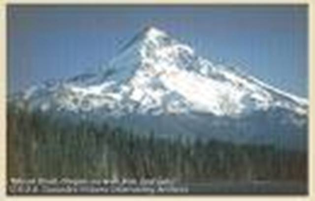 |
A view of Mount Hood |
July 9